


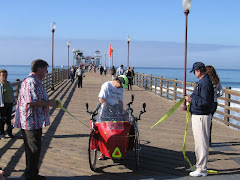
I left Roswell after recharging my batteries (literally & figuratively). I worked hard to get something for day 16. My distance for that day is totaled at 9:26am Pacific time so pushed for 50k, I got just about as close as you can get. I was on the road with no place to really take a break so I carried on with a gentle tail wind and a gradual decent :) to Plains, TX. I arrived to find the town about to roll up the streets. I had 15 mins to get some food at the DQ before they closed at 8:00pm. The other Mexican restaurant had already closed. I decided to call it a day and found a place to park the Zzzoomer and set up camp.
I started before sunrise so that I could finish out Day 17 with over 100 miles. I had to work hard to get to Brownfield because the wind had changed direction during the night in advance of an approaching storm. As I write this I am considering a severe weather advisory (see below:)
I was just finishing up this blog and the waitress told me that my meal was paid for by one of the patrons. I don't even know who. It constantly amazed at the friendliness and generosity of the people I have met on this adventure.
Special Weather Statement
PARMER-CASTRO-SWISHER-BRISCOE-HALL- CHILDRESS-BAILEY-LAMB-HALE- FLOYD- MOTLEY-COTTLE-COCHRAN-HOCKLEY-LUBBOCK- CROSBY-DICKENS-KING- YOAKUM-TERRY-LYNN- GARZA-KENT-STONEWALL- INCLUDING THE CITIES OF...FRIONA...BOVINA... DIMMITT...HART... TULIA...SILVERTON... QUITAQUE...MEMPHIS...TURKEY... CHILDRESS... MULESHOE...LITTLEFIELD... OLTON...PLAINVIEW...FLOYDADA... LOCKNEY... MATADOR...ROARING SPRINGS... PADUCAH...MORTON...LEVELLAND... LUBBOCK...SLATON...WOLFFORTH... CROSBYTON...RALLS...DICKENS... SPUR... GUTHRIE...PLAINS...DENVER CITY... BROWNFIELD...TAHOKA... O'DONNELL... POST...JAYTON...ASPERMONT 535 AM CST WED MAR 5 2008
...ANOTHER ROUND OF LIGHT SNOW POSSIBLE TONIGHT AND THURSDAY...
AN APPROACHING STORM SYSTEM COMBINED WITH AN INFLUX OF COLD AIR WILL RESULT IN A CHANCE OF SNOWFALL FOR AREAS ON THE CAPROCK ESCARPMENT TONIGHT AND THURSDAY MORNING WITH A RAIN AND SNOW MIX POSSIBLE ACROSS THE ROLLING PLAINS. PRECIPITATION CHANCES ARE GREATEST IN THE EXTREME SOUTHWESTERN PANHANDLE AND THE NORTHWESTERN SOUTH PLAINS...GENERALLY WEST OF A MORTON TO TULIA LINE. ACROSS THOSE AREAS 1 TO 2 INCHES OF SNOW WILL BE POSSIBLE... ALTHOUGH LIGHTER AMOUNTS ARE CURRENTLY ANTICIPATED FOR MOST AREAS.


No comments:
Post a Comment